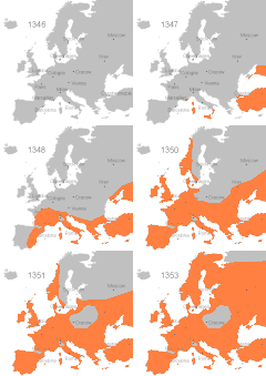
Պատկեր:Blackdeath2.gif
Blackdeath2.gif (450 × 422 կէտիկներ, նիշքի չափը՝ 17 ԿԲ, MIME-տեսակը՝ image/gif, looped, 7 frames, 11 վ)
Նիշքի պատմութիւն
Սեղմել օրուան/ժամին վրայ նիշքի այդ պահուն ունեցած վիճակը տեսնելու համար
| Օր/Ժամ | Մանրապատկեր | Ծաւալ | Գործածող | Մեկնաբանութիւն | |
|---|---|---|---|---|---|
| ընթացիկ | 21:00, 14 Փետրուար 2016 |  | 450 × 422 (17 ԿԲ) | FiP | Corrected name of French Town Marseilles |
| 21:00, 14 Փետրուար 2016 |  | 450 × 422 (17 ԿԲ) | FiP | Corrected name of French Town Marseilles | |
| 04:17, 3 Նոյեմբեր 2011 |  | 450 × 422 (17 ԿԲ) | Saibo | Iceland jumped by 1 pixel in 1351. Fixed | |
| 15:43, 28 Հոկտեմբեր 2011 |  | 450 × 422 (18 ԿԲ) | Stevepickering | Removed the "AdGif - UNREGISTERED" watermark, also reduced filesize. | |
| 11:40, 7 Հոկտեմբեր 2011 |  | 450 × 422 (52 ԿԲ) | Il Dottore | back | |
| 11:37, 7 Հոկտեմբեր 2011 |  | 450 × 422 (7 ԿԲ) | Il Dottore | - надпись | |
| 18:59, 18 Մարտ 2011 |  | 450 × 422 (52 ԿԲ) | Chris55 | removed Iceland from affected countries | |
| 08:34, 20 Մարտ 2007 |  | 450 × 422 (52 ԿԲ) | Roke~commonswiki | Map from wikipedia by Andrei nacu Black Death strikes Europe {{PD-User|Andrei nacu}} Category:Animated maps of Europe |
Նիշքի գործածութիւն
Այս նիշքին յղուող էջեր չկան։
Նիշքի համընդհանուր օգտագործում
Հետեւեալ ուիքիները եւս կ'օգտագործեն այս նիշքը՝
- Օգտագործումը bg.wikipedia.org կայքին վրայ
- Օգտագործումը ca.wikipedia.org կայքին վրայ
- Օգտագործումը cdo.wikipedia.org կայքին վրայ
- Օգտագործումը cs.wikipedia.org կայքին վրայ
- Օգտագործումը da.wikipedia.org կայքին վրայ
- Օգտագործումը de.wikipedia.org կայքին վրայ
- Օգտագործումը diq.wikipedia.org կայքին վրայ
- Օգտագործումը en.wikipedia.org կայքին վրայ
- Օգտագործումը en.wikibooks.org կայքին վրայ
- Օգտագործումը eo.wikipedia.org կայքին վրայ
- Օգտագործումը es.wikipedia.org կայքին վրայ
- Օգտագործումը et.wikipedia.org կայքին վրայ
- Օգտագործումը eu.wikipedia.org կայքին վրայ
- Օգտագործումը fa.wikipedia.org կայքին վրայ
- Օգտագործումը fo.wikipedia.org կայքին վրայ
- Օգտագործումը fr.wikipedia.org կայքին վրայ
- Օգտագործումը gl.wikipedia.org կայքին վրայ
- Օգտագործումը hak.wikipedia.org կայքին վրայ
- Օգտագործումը hr.wikipedia.org կայքին վրայ
- Օգտագործումը hu.wikipedia.org կայքին վրայ
- Օգտագործումը hy.wikipedia.org կայքին վրայ
- Օգտագործումը incubator.wikimedia.org կայքին վրայ
- Օգտագործումը is.wikipedia.org կայքին վրայ
- Օգտագործումը it.wikipedia.org կայքին վրայ
- Օգտագործումը ja.wikipedia.org կայքին վրայ
- Օգտագործումը ka.wikipedia.org կայքին վրայ
- Օգտագործումը kk.wikipedia.org կայքին վրայ
- Օգտագործումը ko.wikipedia.org կայքին վրայ
- Օգտագործումը ku.wikipedia.org կայքին վրայ
- Օգտագործումը kw.wikipedia.org կայքին վրայ
- Օգտագործումը lv.wikipedia.org կայքին վրայ
- Օգտագործումը nn.wikipedia.org կայքին վրայ
- Օգտագործումը pl.wikipedia.org կայքին վրայ
- Օգտագործումը pl.wikibooks.org կայքին վրայ
- Օգտագործումը ps.wikipedia.org կայքին վրայ
- Օգտագործումը pt.wikipedia.org կայքին վրայ
Տեսնել այս նիշքի աւելի համընդհանուր օգտագործումը:


