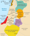
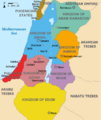
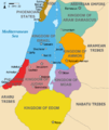
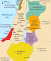
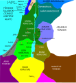
Պատկեր:Kingdoms of Israel and Judah map 830.svg

Size of this PNG preview of this SVG file: 502 × 599 կէտիկ. Այլ չափեր: 201 × 240 կէտիկ | 402 × 480 կէտիկ | 644 × 768 կէտիկ | 858 × 1024 կէտիկ | 1717 × 2048 կէտիկ | 720 × 859 կէտիկ.
Սկզբնական նիշք (SVG նիշք, անուանապէս 720 × 859 կէտիկ, նիշքի չափը՝ 96 ԿԲ)
Նիշքի պատմութիւն
Սեղմել օրուան/ժամին վրայ նիշքի այդ պահուն ունեցած վիճակը տեսնելու համար
| Օր/Ժամ | Մանրապատկեր | Ծաւալ | Գործածող | Մեկնաբանութիւն | |
|---|---|---|---|---|---|
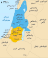
| ընթացիկ | 14:12, 1 Հոկտեմբեր 2021 |  | 720 × 859 (96 ԿԲ) | Sadopaul | File uploaded using svgtranslate tool (https://svgtranslate.toolforge.org/). Added translation for ko. |
| 15:50, 10 Փետրուար 2017 |  | 720 × 859 (80 ԿԲ) | Malus Catulus | removed 'Sizu' - a weird artifact from the Norse original | |
| 23:48, 12 Փետրուար 2011 |  | 720 × 859 (78 ԿԲ) | Malus Catulus | - | |
| 11:29, 13 Յուլիս 2010 | 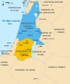 | 720 × 859 (79 ԿԲ) | Malus Catulus | Fixed Judah color | |
| 10:51, 13 Յուլիս 2010 |  | 720 × 859 (79 ԿԲ) | Malus Catulus | Added colors for the two kingdoms and converted their text to path and arial | |
| 23:53, 12 Յուլիս 2010 |  | 720 × 859 (62 ԿԲ) | Malus Catulus | Shrinked down the borders | |
| 19:43, 12 Յուլիս 2010 |  | 720 × 859 (62 ԿԲ) | Malus Catulus | {{Information |Description={{en|1=Map showing the ancient levant borders and ancient cities such as Urmomium and Jerash. The map also shows the region in the 9th century BCE. Notice the coastal land of Philistia, from which the name "Palestine |
Նիշքի գործածութիւն
Հետեւեալ էջը կը յղուի այս նիշքին՝
Նիշքի համընդհանուր օգտագործում
Հետեւեալ ուիքիները եւս կ'օգտագործեն այս նիշքը՝
- Օգտագործումը af.wikipedia.org կայքին վրայ
- Օգտագործումը als.wikipedia.org կայքին վրայ
- Օգտագործումը arz.wikipedia.org կայքին վրայ
- Օգտագործումը azb.wikipedia.org կայքին վրայ
- Օգտագործումը az.wikipedia.org կայքին վրայ
- Օգտագործումը be-tarask.wikipedia.org կայքին վրայ
- Օգտագործումը be.wikipedia.org կայքին վրայ
- Օգտագործումը bg.wikipedia.org կայքին վրայ
- Օգտագործումը bn.wikipedia.org կայքին վրայ
- Օգտագործումը br.wikipedia.org կայքին վրայ
- Օգտագործումը bs.wikipedia.org կայքին վրայ
- Օգտագործումը bxr.wikipedia.org կայքին վրայ
- Օգտագործումը ca.wikipedia.org կայքին վրայ
- Օգտագործումը cdo.wikipedia.org կայքին վրայ
- Օգտագործումը cs.wikipedia.org կայքին վրայ
- Օգտագործումը da.wikipedia.org կայքին վրայ
- Օգտագործումը de.wikipedia.org կայքին վրայ
- Օգտագործումը de.wikibooks.org կայքին վրայ
- Օգտագործումը en.wikipedia.org կայքին վրայ
Տեսնել այս նիշքի աւելի համընդհանուր օգտագործումը:


